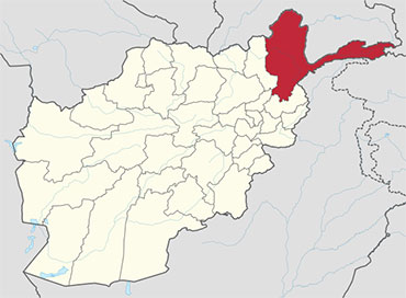
Badakhshan in the Afghanistan Map
Badakhshan is one of the 34 provinces of Afghanistan, consisting of 28 districts and having its capital at Feyzabad. It is located in the north-east of the country, between the Hindu Kush and the Amu Darya. It is part of a broader historical Badakhshan region.
Geography
Badakhshan is primarily bordered by Gorno-Badakhshan Autonomous Province and Khatlon Province in Tajikistan to the north and east. In the east of the province a long spur called the Wakhan Corridor extends above northern Pakistan’s Chitral and Northern Areas to a border with China. The province has a total area of 44,059 km², most of which is occupied by the Hindu Kush and Pamir mountain ranges.
Badakhshan was a stopover on the ancient Silk Road trading path, and China has shown great interest in the province after the fall of the Taliban, helping to reconstruct roads and infrastructure.
According to the World Wildlife Fund, Badakhshan contains temperate grasslands, savannas, and shrublands, as well as Gissaro-Alai open woodlands along the Pamir River. Common plants found in these areas include pistachio, almond, walnut, apple, juniper, and sagebrush.
Montane Grasslands and Shrublands are also existent in the province, with the Hindu Kush alpine meadow located in the high mountains in the northern and southwestern regions.
The Wakhan corridor contains two montane grassland and shrubland regions, the Karakoram-West Tibetan Plateau alpine steppe and in the Pamir Mountains.
South of Fayzabad the terrain becomes dominated by deserts and xeric shrublands. Common vegetation includes thorny bushes, zizyphus, acacia, and Amygdatus. Paropamisus xeric woodlands can be found in the province’s northwestern and central areas. Common vegetation includes almond, pistachio, willows, and sea-buckthorn.
History
Badakhshan etymologically derives from the Sassanid word badaxš, an official title. The suffix of the name, -ān, means the region belonged to someone with the title badaxš. This Sassanid naming convention is seen in other Central Asian locations, including Azerbaijan, Isfahan, and Tehran.
Badakhshan and Panjshir were the only provinces that were never occupied or captured by the Taliban during their drive to control the country.[4] However, during the course of the wars a non-Taliban Islamic emirate was established in Badakhshan by Mawlawi Shariqi, paralleling the Islamic Revolutionary State of Afghanistan in neighboring Nuristan. Burhanuddin Rabbani, a Badakhshan native, and Ahmad Shah Massoud were the last remnants of the anti-Taliban Northern Alliance during the peak of Taliban control in 2000 and 2001, and they used the province as their base of operations.
Economics
Despite massive mineral reserves, Badakhshan is one of the most destitute areas in the world. Opium poppy growing is the only real source of income in the province and Badakhshan has one of the highest rates of maternal mortality in the world, due to the complete lack of health infrastructure, inaccessible locations, and bitter winters of the province.
Lapis lazuli has been mined in the Sar-e-Sang mines, located in the Kuran wa Munjan District of Badakhshan, for over 6,000 years. The mines were the largest and most well-known source in ancient times.
Most recent mining activity has focused on lapis lazuli, with the proceeds from the lapis mines being used to fund Northern Alliance troops, and before that, anti-Soviet Mujahideen fighters. Recent geological surveys have indicated the location of other gemstone deposits, in particular rubies and emeralds. Exploitation of this mineral wealth could be key to the region’s prosperity
Capital City
Fayzabad, the capital of Badakhshan, sits on the Kokcha River and has an approximate population of 50,000. The chief commercial and administrative center of northeast Afghanistan and the Pamir region, Fayzabad also has rice and flour mills. During the winter the city is sometimes isolated by deep snow. In 1979 it was a focus of Afghan guerrillas attempting to repel the Soviet invasion. Fayzabad was taken by Soviet forces in 1980 and became a major garrison town.
| Province | Population | Area |
|---|---|---|
| Arghanj Khwa | 12,000 | |
| Argo | 83,999 | 1,032 km2 |
| Baharak | 33,012 | 328 km2 |
| Chitral | 37,800 | 14850 km2 |
| Darayim | 72,000 | 570 km2 |
| Fayzabad | 96,826 | 514 km2 |
| Ishkashim | 12,566 | 1,123 km2 |
| Jurm | 51,714 | 1286 km2 |
| Khash | 15,436 | 264 km2 |
| Khwahan | 27,000 | 80 km2 |
| Kishim | 71,262 | 264 km2 |
| Kohistan | 12,000 | |
| Kuf Ab | 16,000 | |
| Keran wa Menjan | 8,084 | 1,588 km2 |
| Maimay | 12,000 | |
| Nusay | 31,195 | 4,589 km2 |
| Raghistan | 37,000 | |
| Shahri Buzurg | 80,000 | 956 km2 |
| Sheghnan | 27,750 | 3528 km2 |
| Shekay | 27,000 | 1,700 km2 |
| Shuhada | 26,430 | 1,521 km2 |
| Tagab | 22,000 | |
| Tishkan | 26,850 | 812 km2 |
| Wakhan | 11,657 | 10,953 km2 |
| Warduj | 16,609 | 929 km2 |
| Yaftali Sufla | 60,000 | 605 km2 |
| Yamgan | 30,000 | 1,779 km2 |
| Yawan | 27,000 | |
| Zebak | 26,430 | 1,521 km2 |


