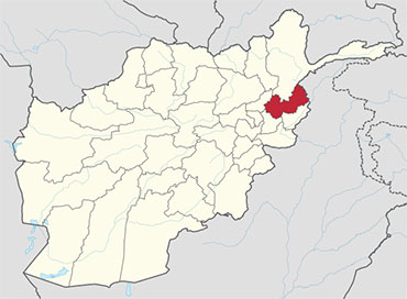
 Nuristan, also spelled Nurestan or Nooristan is one of the 34 provinces of Afghanistan, located in the eastern part of the country. It is divided into seven districts and has a population of about 140,900. Parun serves as the provincial capital.
It was formerly known as Kafiristan (کافرستان, “land of the infidels”) until the inhabitants were converted to Islam in 1895, and thence the region has become known as Nuristan (“land of light”).
The primary occupations are agriculture, animal husbandry, and day labor. Located on the southern slopes of the Hindu Kush mountains in the northeastern part of the country, Nuristan spans the basins of the Alingar, Pech, Landai Sin, and Kunar rivers. Nuristan is bordered on the south by Laghman and Kunar provinces, on the north by Badakhshan province, on the west by Panjshir province, and on the east by Khyber Pakhtunkhwa, Pakistan.
History
Early History
The surrounding area fell to Alexander the Great in 330 B.C. It later fell to Chandragupta Maurya. The Mauryas introduced Hinduism and Buddhism to the region, and were attempting to expand their empire to Central Asia until they faced local Greco-Bactrian forces. Seleucus is said to have reached a peace treaty with Chandragupta by giving control of the territory south of the Hindu Kush to the Mauryas upon intermarriage and 500 elephants.
Having consolidated power in the northwest, Chandragupta pushed east towards the Nanda Empire. Afghanistan’s significant ancient tangible and intangible Buddhist heritage is recorded through wide-ranging archeological finds, including religious and artistic remnants. Buddhist doctrines are reported to have reached as far as Balkh even during the life of the Buddha (563 BCE to 483 BCE), as recorded by Xuanzang.
The region was historically known as Kafiristan (meaning “Land of the kafirs”) because of its inhabitants: the Nuristani, an ethnically distinctive people who practiced a form of ancient Hinduism. It was conquered by Emir Abdur Rahman Khan in the late 19th century and the Nuristani people began converting to Islam.
The region was renamed Nuristan, meaning Land of the enlightened, a reflection of the “enlightening” of the pagan Nuristani by the “light-giving” of Islam.
Nuristan was once thought to have been a region through which Alexander the Great passed with a detachment of his army; thus the folk legend that the Nuristani people are descendants of Alexander (or “his generals”).
Abdul Wakil Khan Nuristani is one of the most prominent figures in Nuristan’s history. He fought against the British-led Punjabi army and drove them out of the eastern provinces of Afghanistan. He is buried on the same plateau where King Amanullah Khan is buried.
Recent History
Since the creation of Pakistan in 1947, Pakistani politicians have been focusing on connecting what is now Tajikistan with Pakistan. This requires weakening Afghan rule in Nuristan and Badakhshan provinces by secretly funding anti-Afghan rebel forces, similar to Kashmir conflict with India. In the meantime, Afghan politicians (particularly Mohammed Daoud Khan) have been focusing on re-annexing Khyber Pakhtunkhwa and the Federally Administered Tribal Areas of what is now Pakistan. This has led to militancy on both sides of the Durand Line border.
Nuristan was the scene of some of the heaviest guerrilla fightings during the 1980s Soviet war in Afghanistan. The province was influenced by Mawlawi Afzal’s Islamic Revolutionary State of Afghanistan, which was supported by Pakistan nationalists and Saudi Arabia. It dissolved under the Islamic Emirate of Afghanistan (Taliban rule) in the late 1990s.
Nuristan is one of the poorest and most remote provinces of Afghanistan. Few NGO’s operate in Nuristan because of Taliban insurgency and lack of safe roads. The United States and the Afghan government are jointly working to solve these issues. Some road construction projects were launched linking Nangarej to Mandol and Chapa Dara to Titan Dara. The Afghan government also worked on a direct road route to Laghman province, in order to reduce dependence on the road through restive Kunar province to the rest of Afghanistan. Other road projects were started aimed at improving the primitive road from Kamdesh to Barg-i Matal, and from Nangalam in Kunar province to the provincial center at Parun.
Since Nuristan is a highly ethnically homogeneous province, there are few incidents of inter-ethnic violence. However, there are instances of disputes among inhabitants, some of which continue for decades. Nuristan has suffered from its inaccessibility and lack of infrastructure. The government presence is under-developed, even compared to neighboring provinces. Nuristan’s formal educational sector is weak, with few professional teachers. Due to its proximity to Pakistan, many of the inhabitants are actively involved in trade and commerce across the border.
A map from the Afghan Ministry of the Interior produced in 2009 showed the western region of Nuristan to be under “enemy control”. There have been numerous conflicts between anti-Afghanistan militants and U.S.-led Afghan security forces. In April 2008 members of the 3rd Special Forces Group led Afghan soldiers from the Commando Brigade into the Shok valley in an unsuccessful attempt to capture warlord Gulbuddin Hekmatyar. In July 2008 approximately 200 Taliban guerrillas attacked a NATO position just south of Nuristan, near the village of Wanat in the Waygal District, killing 9 U.S. soldiers. In the following year, in early October, more than 350 anti-Afghanistan militants backed by members of the Hezb-e Islami Gulbuddin and other militia groups fought U.S.-led Afghan security forces in the Battle of Kamdesh at Camp Keating in Nuristan. The base was nearly overrun; more than 100 Taliban fighters, eight U.S. soldiers, and seven members of the Afghan security forces were killed during the fighting. Four days after the battle, in early October 2009, U.S. forces withdrew from their four main bases in Nuristan, as part of a plan by General Stanley McChrystal to pull troops out of small outposts and relocate them closer to major towns. The U.S. has pulled out from some areas in the past, but never from all four main bases. A month after the U.S. pullout the Taliban was governing openly in Nuristan. According to The Economist, Nuristan is “a place so tough that NATO abandoned it in 2010 after failing to subdue it.
Healthcare
The percentage of households with clean drinking water increased from 2% in 2005 to 12% in 2011. The percentage of births attended to by a skilled birth attendant increased from 1% in 2005 to 22% in 2011.
Demography
As of 2013, the total population of the province is about 140,900. According to the Naval Postgraduate School, around 99.3% are Nuristanis and 0.6% Gujjars.
Districts
Nuristan province is divided into about districts.
| District | Population | Area |
|---|---|---|
| Barg-i Matal | 15,000 | |
| Du Ab | 7,700 | |
| Kamdesh | 24,500 | |
| Mandol | 19,200 | |
| Nurgram | 31,400 | |
| Parun | 13,200 | |
| Wama | 10,800 | |
| Waygal | 19,100 |


